


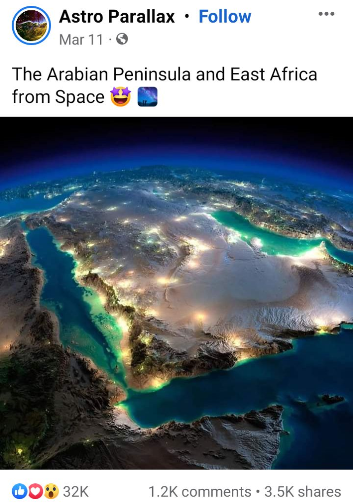
Recently, a photo claiming “The Arabian Peninsula and East Africa from space” went viral on Facebook.
See some Facebook posts on this claim here (archive), here (archive) and here (archive).
Rumor Scanner has seen similar claims spread over the past years as well.
Check out some of these Facebook posts –
2022 – here (archive) and here (archive).
Fact Check
According to the Rumor Scanner investigation, The image being circulated is not an image of the Arabian Peninsula and East Africa taken from space, rather a computer rendering image is being circulated claiming to be real.
Through the reverse image search method, the image discussed in a report published on August 6, 2017 titled “These unbelievable space images of Earth at night are a bunch of beautiful fakes” was found on the website of the US media ‘Insider’.
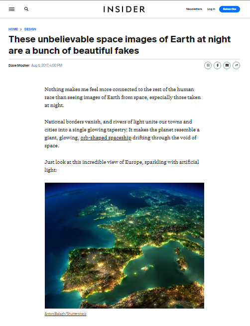
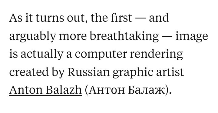
According to the report, several other images spread on the Internet along with this image are mainly created through computer rendering. These images were created by Russian graphic artist Anton Balazh.
Insider said, For realism Balazh downloaded countless gigabytes of real satellite images from NASA’s Visible Earth catalogs. Then spliced in ocean depth (or bathymetry) data for a realistic-looking seafloor & sea level data for accurate-looking coastlines. And, using NASA-based topography data, he exaggerated the height of mountain ranges that would normally look flat from space. Balazh also layered in city light data collected by the Suomi NPP satellite, which orbits the Earth.
Insider’s report cites Balazh’s ‘Shutterstock’ account as the source of the images.
Later, the original image was found on US-based stock photography site ‘Shutterstock’.
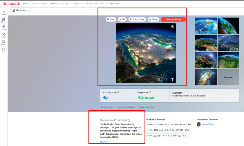
The caption of the photo on Shutterstock stated, “Highly detailed Earth, illuminated by moonlight. The glow of cities sheds light on the detailed exaggerated terrain. Night Earth. Saudi Arabia. Elements of this image furnished by NASA.”
When the Rumor Scanner team later contacted Anton Balazs, he said, “Obviously the picture is not a real photograph, it’s an illustration. NASA resources were used to make it.”
Bottom Line
Russian graphic artist Anton Balazh created several illustrations of Earth through computer rendering using NASA resources. Among them, a picture is being circulated claiming pictures of the Arabian Peninsula and East Africa taken from space at various times.
Incidentally, Rumor Scanner published the Fact Check report after an image created with the help of digital technology, previously showing the extent of sea ice around Antarctica, was spread over factual claims.
So, computer-rendered images are being circulated in facebook to claim images of the Arabian Peninsula and East Africa taken from space; Which is completely false.
Sources
- Insider: These unbelievable space images of Earth at night are a bunch of beautiful fakes
- Statement from Anton Balazh
- Shutterstock: Highly detailed Earth, illuminated by moonlight.